The Bataan National Park (BNP) is a protected national park since 1945. It covers almost the entire northern Bataan peninsula, spans 23,600 hectares, and goes across seven towns and cities (Hermosa, Orani, Samal, Abucay, Balanga, Bagac, and Morong). It is one of the last remaining closed-canopy dipterocarp rainforests of the Philippines. Dipterocarpaceae refers to lowland tropical rainforest trees. The name is Greek in origin (di = two, ptero = wings, karpo = fruit) that translate to two-winged fruit trees.

The perimeters of the Bataan National Park as seen from Sinagtala Resort.

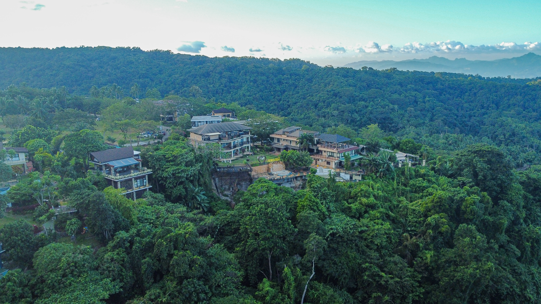
Tanawin and other houses in Sinagtala surrounded by the Bataan National Park
The BNP has several waterfalls such as the Dunsulan and Pasukulan Falls, Orani River, streams, and important endemic species of flowers, orchids, and several wild monkeys, insects and birds. It is also known to have tropical leeches in the rainy season (as most tropical rainforests do!).
The peak, Mount Natib, is a dormant volcano resting at the center of the park. It is six (6) by seven (7) km wide, acorn-shaped, forested, and a caldera (cauldron) complex. A caldera is a large cauldron-like hollow that forms after the emptying of magma in a volcanic eruption. The last eruption cannot be determined exactly by scientists, but is estimated between 27,000 - 69,000 years ago. (Definitely dormant and unlikely to erupt anytime soon!) The highest peak of Mt. Natib is at 1,253 meters (4,111 feet).

The peak of Mt. Natib with clouds, taken from Tanawin
Most mountaineers take around 7 hours to reach the peak and camp and spend the night there. It is also possible to do a day-climb and go down on the same day. A 360-degree view of Manila Bay, Subic Bay, and the metropolises could be seen through the clouds. A plaque stating American soldiers took refuge there during World War 2 is also at the peak. 
The Binutas or 'mountain pass' rim which gives a good view of the caldera, Subic Bay in the west, and peak of Mt. Natib (but not seen in the photo).
For the non-mountaineers, Binutas or "mountain pass" is an alternative to get a closer look of Mt. Natib, the rolling dipterocarp forests, and the surrounding caldera complex. It is accessible by foot, motorcycle, or a 4x4 vehicle.
Note: it is best to go up to Binutas and Mt. Natib with an experienced guide. If you are interested, please let a Tanawin or Sinagtala Resort staff know.
References: Bataan National Park, Wikipedia
Stories from people who have climbed to the top of Mt. Natib